
Decentralized sources
Video, sensors, and urban service logs can remain distributed across systems and teams.
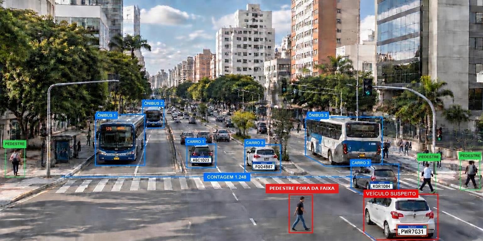
Connected information for smart security in urban operations.
Tell us about your projectWe turn footage of roadways and urban spaces into traffic intelligence and operational events, routed to authorized teams.
The solution is validated at designated points before expanding coverage.
Video, sensors, and urban service logs can remain distributed across systems and teams.
Weather, lighting, movement, and uneven coverage across areas impact image analytics.
Response to urban events depends on well-defined routing criteria and responsibilities.
We start from service priorities and available infrastructure. We define which events to track, who receives each piece of information, and how to validate the solution in an initial scope before expanding coverage.
Count vehicles and pedestrians and track traffic flow and occupancy per capture point.
Log license plates with image and timestamp, correlating them with lists defined by operations.
Flag conditions such as jaywalking according to configured rules.
Route each event to authorized teams via configured channels.
Organize time series and aggregate indicators for mobility analysis.
Analytics accuracy depends on capture points, weather, and lighting, and is verified during the proof of concept. Third-party integrations depend on available interfaces and permissions.
Track vehicle volume throughout the day.
Alert the monitoring center when a watchlist license plate is read.
Flag pedestrians outside crosswalks at monitored points.
Send the event with an image to the responsible team.
Illustrative examples. Events and routing are defined for each project.
Events can be shared with operations centers and incident management systems, depending on available interfaces and permissions.
We understand the goals, processes, and existing systems.
We define the solution, integrations, and infrastructure requirements.
We configure, customize, and connect the features planned for the project.
We test the solution in the live environment and guide teams.
We monitor operations according to the contracted scope and identify improvements.
Tell us your service priorities. We will design an initial scope with your team.